Planning infrastructure for future integrated ferry services study
The Northern Territory Government is investigating potential sites and planning infrastructure to expand Darwin’s ferry services over the next 50 years.
The Department of Infrastructure, Planning and Logistics has engaged maritime infrastructure specialists Mott MacDonald to analyse a number of potential sites for future ferry terminals.
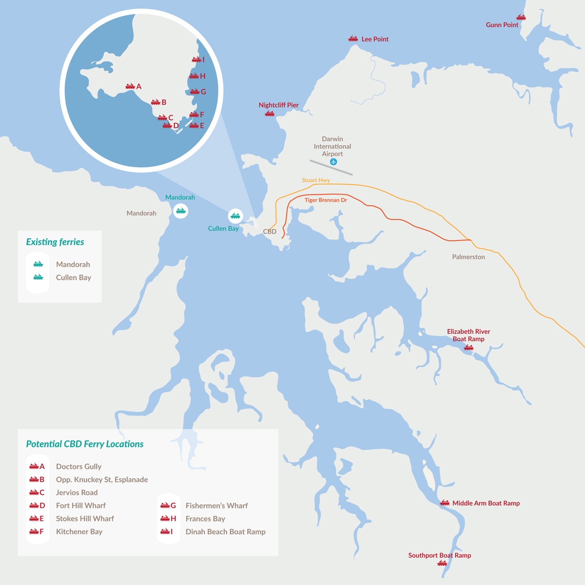
Locations being considered are featured on the map below.

An important feature of the long-term planning study will be to consider how potential ferry site locations integrate with other transport options such as bus routes, cycle and pedestrian paths as well as existing and future road networks.
The Darwin Regional Land Use Plan estimates:
- 130 000 people will be living in the greater Darwin region in the short term
- 250 000 people in the next 40 to 50 years.
The analysis will look at trigger points for future demand for ferry transport over a 50-year period.
The study will also consider water depth, land tenure, access and prevailing weather conditions, environmental sensitivities as well as servicing and infrastructure requirements for future long-term ferry facilities such as pontoons, jetties, dredging, ferry terminal and parking.
Potential tourism opportunities and community benefits for a broad range of harbour users will also be considered.
Previous announcement
Read the news item - Preferred sites announced for long term future ferry planning.
Contact
Email: ferryplanning@nt.gov.au
Phone: 08 8981 6445
Give feedback about this page.
Share this page:
URL copied!