

Stuart Highway Road Safety Improvements– Stuart Park
Latest update
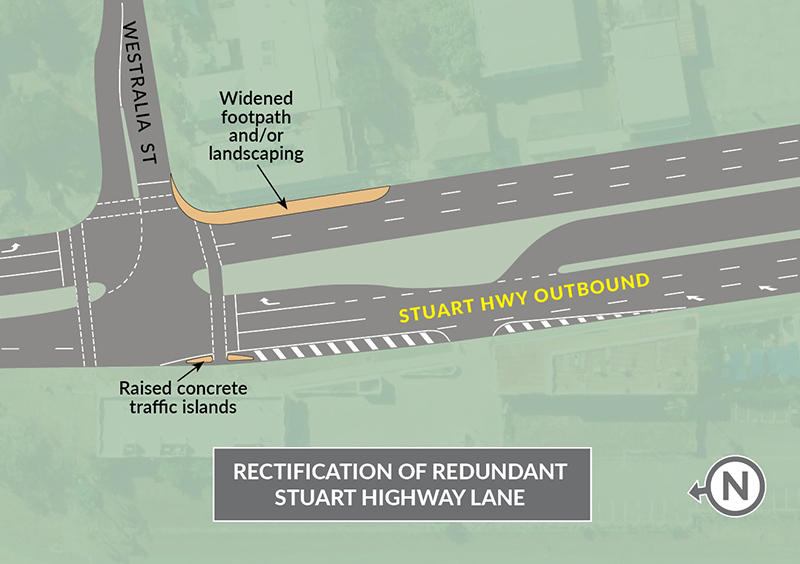
The Department of Infrastructure, Planning and Logistics (DIPL) is preparing to undertake detailed design for road safety improvements on the Stuart Highway, from Armidale Street to the Westralia Street intersections in Stuart Park.
The project will enhance road safety for all road users and improve traffic flow at intersections by separating the turning traffic from the through traffic, and pedestrians and cyclists from vehicles.
Preliminary concept designs includes:
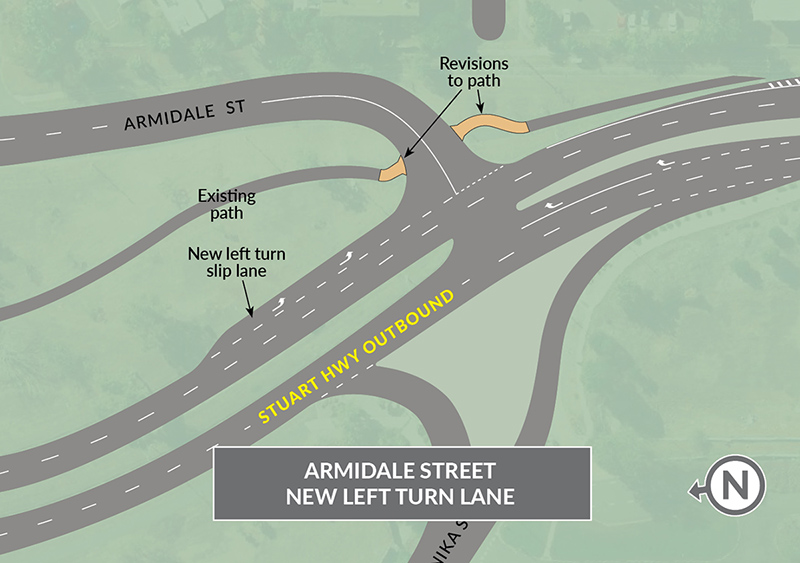
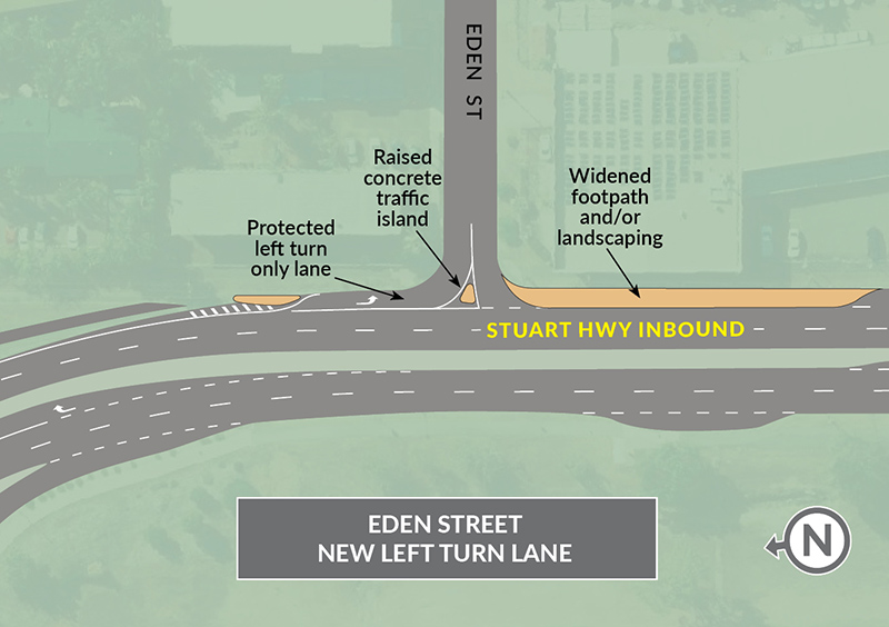
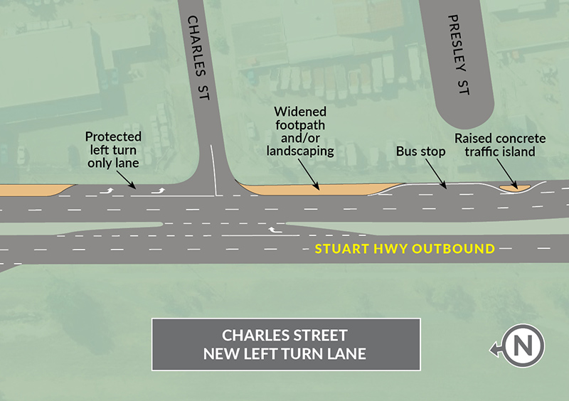
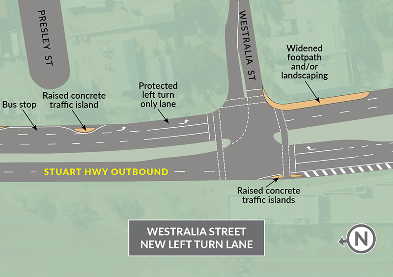
- dedicated left-turn lanes for Armidale Street, Eden Street, Charles Street, and Westralia Street from the Stuart Highway
- full protection for pedestrians and cyclists at the traffic signals of the Stuart Highway/ Westralia Street intersection
- line marking and signage for improved delineation and channelisation.
Draft concept design maps
You can download the full view of the concept designs for the Stuart Highway Road Safety Improvements PDF (812.5 KB).
Consultation
The department has commenced consultation on the initial concept designs with businesses and key stakeholders.
This consultation will inform the final scope of the detailed design project.
This project is in its early design planning stage and any construction to complete the project will be subject to availability of funding once the detailed design is completed.
Give feedback about this page.
Share this page:
URL copied!